Pixel Intelligence
Lat 56.63° • Lon -66.40°
2026-09-13
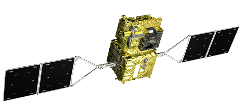
GCOM-C (Shikisai) • SGLI
Land Surface Temp (Daytime)
47.4
Significant High
Anomaly
Anomaly
Native Res
250 m (Global 5 km)
Product Level
Level 3 Standard
Previous Pass
--.- °C
Change %
--.-%
Historical Baseline & Context
Baseline: 41.96 °C
Z-Score: +2.02σ (+5.47
°C)
Record Low
Mean
Record High
97.8th Percentile
In highest 2.2% of all historical observations
30-Day Micro Trend
Detection Rationale & Drivers
- Values aligned with seasonal baseline
CRITICAL
EVT-2026-001
Planetary Event Title
Nile Delta Agricultural Belt, Egypt
Land Surface Temp • GCOM-C SGLI
Current Observed
--.-
Climatic Baseline
--.-
Net Anomaly
--.-%
Affected Footprint
-- px
Persistence Duration
-- days
Confidence Rating
--%
DETECTION RATIONALE & SPATIAL VERIFICATION
JAXA Earth API v2.0.1
REAL-TIME SATELLITE RASTER
JAXA Agent
AI-Powered Earth Observation • Precision Geo-Coordinates &
Anomaly Pinpointer
Targeting Settings
SYSTEM READY
Select a satellite dataset and date, then click «Locate Extreme
Coordinates».
The agent will scan the satellite pixel array within the selected bounds and pinpoint the extreme location with precision.
The agent will scan the satellite pixel array within the selected bounds and pinpoint the extreme location with precision.
JAXA SATELLITE RASTER SCAN
Connecting to JAXA STAC Catalog
servers...
COORDINATES DETECTED
GCOM-C SGLI
Detected Value at
Peak:
--
--
Geographic Location:
--
Latitude
--.----° N
Longitude
--.----° E
Agency: Japan Aerospace Exploration Agency (JAXA)
Protocol: STAC & Cloud-Optimized GeoTIFF (v2.0.1)
JAXA GCOM-W
AMSR2
OBSERVING...
Pacific Thermal Anomaly Radar
Sea Surface Temperature Anomaly Field • Equatorial
Ocean Dynamics • Nile Teleconnections
ANALYZING SST ANOMALY...
--.--
°C
Observed: --.- °C
Normal: --.- °C
La Niña ≤-0.5°
Neutral
El Niño ≥+0.5°
EGYPT & NILE BASIN LINKAGE
Connecting to JAXA planetary climate teleconnections for Nile Basin water resources, Red Sea marine heat, and local weather patterns...
SST THERMAL ANOMALY FIELD
Observed Date
−3.0°C (La Niña)
+3.0°C (El Niño)
12-MONTH ANOMALY TRAJECTORY
• El Niño (+0.5°C)
• La Niña (-0.5°C)
Satellite Radiometer: GCOM-W AMSR2 • Baseline: JMA
COBE-SST Normal
FULL-RESOLUTION SATELLITE
RASTER
PACIFIC BASIN THERMAL ANOMALY MAP
GCOM-W AMSR2 Microwave Radiometer − 30-Year Climatological Mean —
−3.0°C (Strong La Niña)
+3.0°C (Strong El Niño)
—
PLANETARY HEALTH & EVENT RADAR
MULTI-SENSOR SATELLITE INTELLIGENCE • JAXA TELEMETRY
PIXEL TELEMETRY
~1.8 km (2D)
27.182° N, 31.254° E
--
LST (Surface Temp)
3D ORBITAL GLOBE
LST · JAXA Real Data
Custom AOI Shapefile
0 km²
Land Surface Temp
°C
10°C
25°C
55°C
Blue: Moderate | Yellow: Warm | Red: Extreme Thermal
Lat 30.04°N Lon 31.23°E
38.4 °C
CLIMATE PULSE
MULTI-YEAR
2000
2000-07-01 • MODIS
+0.00 °C
Mean Reading
vs. Baseline Year (2000)
2000
2026